It’s a Rainy Day and It’s Monday…Go Figure!
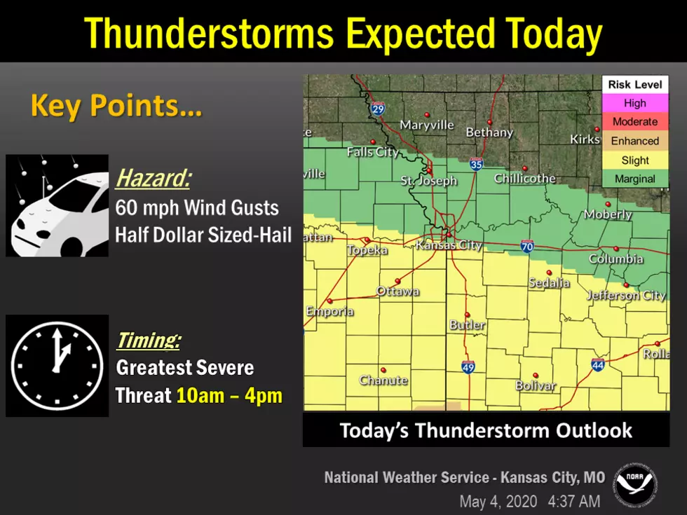
Strong to severe thunderstorms are expected late this morning into the mid-afternoon hours. A few of these storms south of the Missouri River may produce large hail and damaging wind gusts.
Here's the forecast for the Sedalia/Whiteman AFB/Warrensburg area according to the National Weather Service:
TodayShowers and thunderstorms before 3pm, then showers and possibly a thunderstorm, mainly after 3pm. Some of the storms could be severe and produce heavy rainfall. High near 68. East southeast wind 7 to 16 mph, with gusts as high as 29 mph. Chance of precipitation is 80%. New rainfall amounts between three quarters and one inch possible.TonightShowers and possibly a thunderstorm before 1am, then a slight chance of showers between 1am and 4am. Some of the storms could be severe and produce heavy rainfall. Low around 51. East wind 8 to 11 mph becoming north northwest after midnight. Chance of precipitation is 80%. New precipitation amounts between a quarter and half of an inch possible.TuesdayPartly sunny, with a high near 65. Northwest wind 11 to 15 mph, with gusts as high as 28 mph.Tuesday NightMostly clear, with a low around 47. Northwest wind 5 to 8 mph becoming calm.WednesdayMostly sunny, with a high near 66. Northwest wind 5 to 10 mph, with gusts as high as 20 mph.Wednesday NightMostly clear, with a low around 44.ThursdayA chance of showers after 1pm. Partly sunny, with a high near 64. Chance of precipitation is 40%.Thursday NightA chance of showers. Mostly cloudy, with a low around 46. Chance of precipitation is 50%.FridayPartly sunny, with a high near 60.Friday NightMostly clear, with a low around 39.SaturdaySunny, with a high near 65.Saturday NightPartly cloudy, with a low around 44.SundayPartly sunny, with a high near 62.
More From KIX 105.7