Enjoy Your President’s Day Weather!
The good news? No snow in the forecast. The bad news? None, really...just some colder temps or should we say average stuff for this time of year.
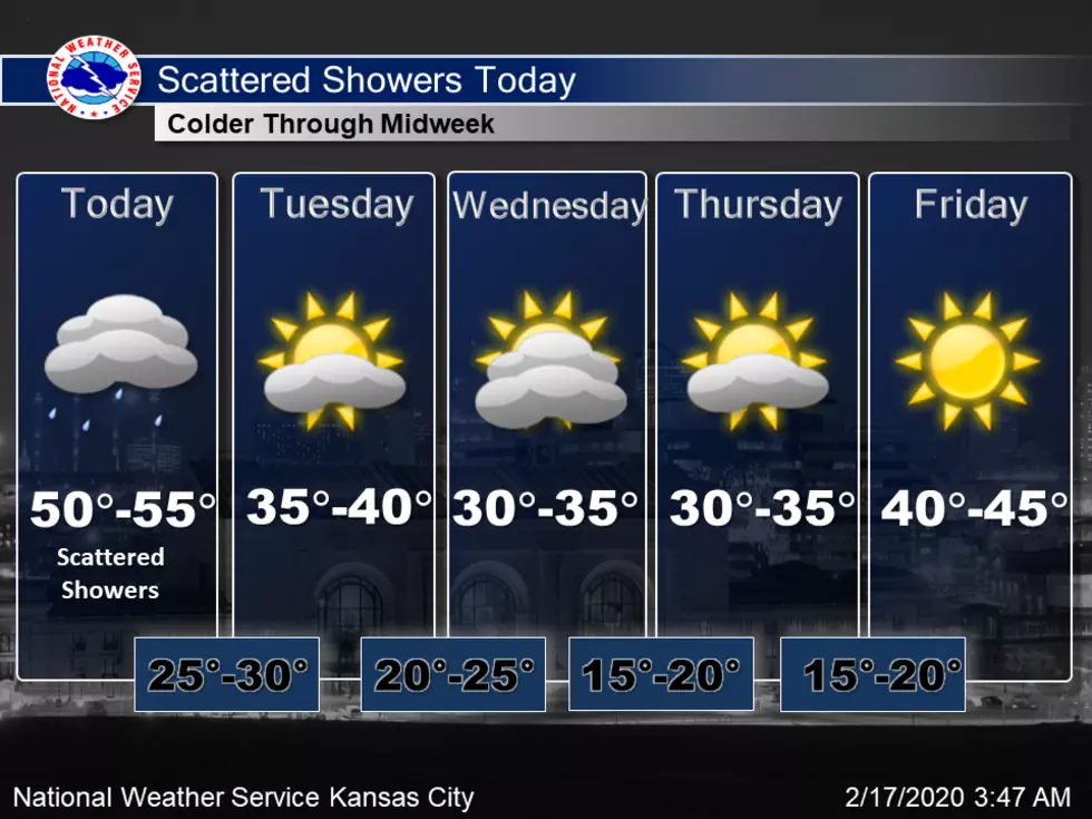
Scattered rain showers are expected today as a cold front moves through the region. That cold front bring colder into the area through the middle of the week. Warmer temperatures are expected by Saturday.
Here's the forecast for the Sedalia/Whiteman AFB/ Warrensburg area according to the National weather Service:
Washington's BirthdayShowers likely, mainly before noon. Patchy fog before 1pm. Otherwise, cloudy, with a high near 55. Light and variable wind becoming west southwest 5 to 7 mph in the morning. Chance of precipitation is 70%. New precipitation amounts of less than a tenth of an inch possible.Monday NightMostly cloudy, with a low around 31. West wind 6 to 14 mph becoming north after midnight. Winds could gust as high as 21 mph.TuesdayPartly sunny, with a high near 39. North wind 7 to 10 mph.Tuesday NightPartly cloudy, with a low around 22. Northeast wind around 6 mph.WednesdayMostly sunny, with a high near 37.Wednesday NightMostly cloudy, with a low around 18.ThursdayMostly sunny, with a high near 32.Thursday NightMostly clear, with a low around 18.FridaySunny, with a high near 42.Friday NightPartly cloudy, with a low around 30.SaturdayPartly sunny, with a high near 49.Saturday NightMostly cloudy, with a low around 33.SundayA chance of rain. Mostly cloudy, with a high near 49. Chance of precipitation is 30%.
More From KIX 105.7