Snow Now the Forecast May Be Correct!
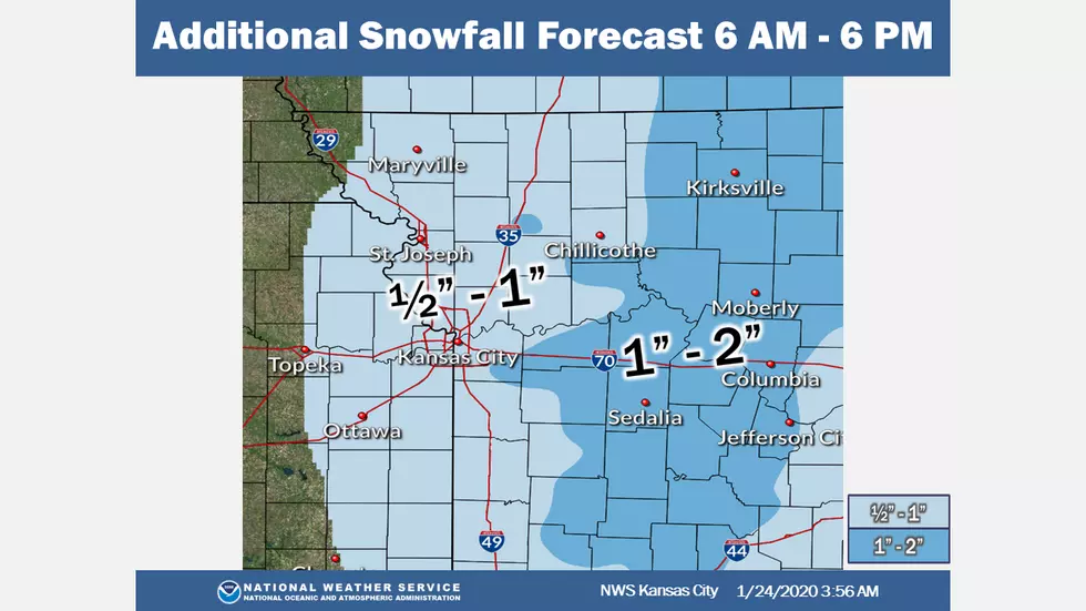
Here's the additional snowfall forecast for 6 AM – 6 PM from the NWS Kansas City.
Snow will continue for eastern Kansas and western Missouri ending around noon. Snow will continue until about 6 PM from northeast Missouri through central Missouri. The next chance for wintry precipitation comes mid-week next week. At this time, that system does not look like it will be high-impact winter weather.
Here's the forecast for the Sedalia/Whiteman AFB, Warresnsburg area according to the National Weather Service:
FridaySnow, mainly before 3pm. High near 31. Northwest wind 11 to 15 mph, with gusts as high as 23 mph. Chance of precipitation is 100%. New snow accumulation of 1 to 3 inches possible.Friday NightMostly cloudy, with a low around 25. West northwest wind 8 to 11 mph, with gusts as high as 20 mph.SaturdayMostly sunny, with a high near 38. West wind 5 to 10 mph becoming light west northwest in the afternoon.Saturday NightMostly cloudy, with a low around 24. Calm wind.SundayMostly cloudy, with a high near 42.Sunday NightPartly cloudy, with a low around 26.MondayPartly sunny, with a high near 43.Monday NightMostly cloudy, with a low around 28.TuesdayA chance of rain after noon. Mostly cloudy, with a high near 40. Chance of precipitation is 30%.Tuesday NightA chance of rain and snow. Mostly cloudy, with a low around 29. Chance of precipitation is 30%.WednesdayMostly cloudy, with a high near 42.Wednesday NightMostly cloudy, with a low around 29.ThursdayPartly sunny, with a high near 44.
More From KIX 105.7