Rolling Into the Last Week of Winter
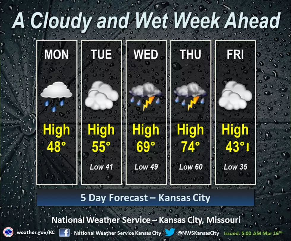
An active weather pattern will bring periodic chances for rain and continued cloud cover for the upcoming week. Thunderstorms with locally heavy rain and the potential for a few strong storms will be possible by mid-week. Look for temperatures to steadily warm each day before a strong cold front drops readings for the end of the work week.
Here's the forecast for the Sedalia/Whiteman AFB/Warrensburg area according to the National Weather Service:
MondayRain likely, mainly before 10am, then a slight chance of drizzle after 1pm. Cloudy, with a high near 48. South wind 3 to 7 mph. Chance of precipitation is 70%. New precipitation amounts of less than a tenth of an inch possible.Monday NightA slight chance of drizzle before 3am. Cloudy, with a low around 41. Calm wind becoming north around 5 mph after midnight.TuesdayCloudy, with a high near 56. North wind 5 to 7 mph becoming east in the afternoon.Tuesday NightShowers, mainly after 1am. Low around 49. South southeast wind 6 to 9 mph. Chance of precipitation is 80%. New precipitation amounts between a quarter and half of an inch possible.WednesdayShowers and possibly a thunderstorm. High near 67. Chance of precipitation is 90%. New rainfall amounts between a half and three quarters of an inch possible.Wednesday NightA chance of showers and thunderstorms, then showers after 1am. Low around 60. Chance of precipitation is 80%.ThursdayShowers and possibly a thunderstorm before 1pm, then a chance of showers and thunderstorms after 1pm. High near 73. Breezy. Chance of precipitation is 90%.Thursday NightMostly clear, with a low around 39. Breezy.FridayPartly sunny, with a high near 47. Breezy.Friday NightMostly cloudy, with a low around 25.SaturdayMostly sunny, with a high near 44.Saturday NightMostly clear, with a low around 29.SundayMostly cloudy, with a high near 48.
More From KIX 105.7