Old Man Winter Is Wanting to Sneak in the Back Door
We're having stretches of days with comfortable fall temperatures and then every once in a while old man winter tries to slip into the picture. Such is the case this week.
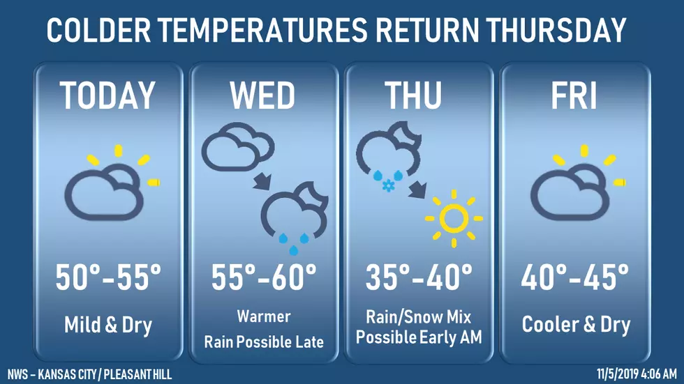
Another mild and dry day today with temperatures in the low to mid 50's under mostly cloudy skies. Wednesday will see temperatures warm several more degrees, but rain chances increase by late afternoon and evening as rain begins to move up from the south. Colder temperatures move in behind a cold front early Thursday with temperatures dropping behind the front. Rain may briefly change to a rain-snow mix or to light snow, but little to no accumulation is expected.
Here's the forecast for the Sedalia/Warrensburg area according to the National Weather Service:
TodayMostly sunny, with a high near 53. Calm wind becoming southeast around 6 mph in the afternoon.TonightMostly clear, with a low around 40. Southeast wind 6 to 9 mph.WednesdayMostly cloudy, with a high near 59. South southwest wind 5 to 10 mph becoming light southeast in the afternoon.Wednesday NightRain likely before 5am, then rain likely, possibly mixed with snow. Cloudy, with a low around 31. Light and variable wind becoming north northeast 9 to 14 mph in the evening. Winds could gust as high as 24 mph. Chance of precipitation is 70%. Little or no snow accumulation expected.ThursdayA chance of rain and snow, mainly between 11am and noon. Cloudy through mid morning, then gradual clearing, with a high near 39. North wind 8 to 15 mph, with gusts as high as 23 mph. Chance of precipitation is 30%.Thursday NightMostly clear, with a low around 20.FridayMostly sunny, with a high near 41.Friday NightMostly clear, with a low around 28.SaturdaySunny, with a high near 54.Saturday NightPartly cloudy, with a low around 34.SundayPartly sunny, with a high near 45.Sunday NightMostly cloudy, with a low around 23.Veterans DayMostly sunny, with a high near 35.
More From KIX 105.7