Into the Last Weekend of April…A Mixture of Rain & Sun
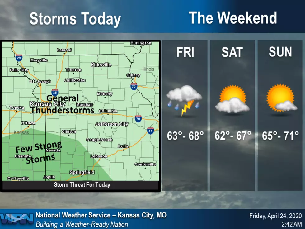
A few rounds of showers and thunderstorms will be possible today. The round of thunderstorms this afternoon will have the potential to produce a few strong storms capable of gusty winds and small hail across portions of east central Kansas and west central Missouri. Highs today will be in the mid 60's.
Here's the forecast according for the Sedalia/Whiteman AFB/Warrensburg area according to the National Weather Service:
FridayShowers and thunderstorms likely, mainly before 4pm, then showers likely and possibly a thunderstorm after 5pm. Cloudy, with a high near 66. Calm wind becoming south southwest around 6 mph in the morning. Chance of precipitation is 70%. New rainfall amounts between a quarter and half of an inch possible.Friday NightShowers likely and possibly a thunderstorm. Some of the storms could produce heavy rainfall. Cloudy, with a low around 50. North northeast wind 6 to 15 mph, with gusts as high as 25 mph. Chance of precipitation is 70%. New precipitation amounts between 1 and 2 inches possible.SaturdayA chance of showers, mainly before 7am. Cloudy, then gradually becoming mostly sunny, with a high near 63. North wind 15 to 18 mph, with gusts as high as 30 mph. Chance of precipitation is 30%. New precipitation amounts of less than a tenth of an inch possible.Saturday NightMostly clear, with a low around 44. North wind 5 to 9 mph becoming calm in the evening.SundaySunny, with a high near 68.Sunday NightPartly cloudy, with a low around 49.MondayPartly sunny, with a high near 72.Monday NightA chance of showers after 1am. Mostly cloudy, with a low around 57. Chance of precipitation is 30%.TuesdayShowers likely and possibly a thunderstorm. Mostly cloudy, with a high near 72. Chance of precipitation is 60%.Tuesday NightA chance of showers and thunderstorms. Partly cloudy, with a low around 52. Chance of precipitation is 30%.WednesdaySunny, with a high near 69.Wednesday NightMostly clear, with a low around 48.ThursdaySunny, with a high near 71.
More From KIX 105.7