West Central Missouri In The Bullseye For Severe Storms Tonight
West Central Missouri finds itself in the bullseye for severe storms tonight according to the National Weather Service Storm Prediction Center. So what kind of weather can we expect tonight, Wednesday, July 12, 2023?
According to a Facebook post from Missouri State Emergency Management Agency, "Severe storms are probable tonight with the highest risk area across portions of west central and southwest MO. The main threats will be large hail and damaging winds most likely between 8:00 PM and 1:00 AM CDT."
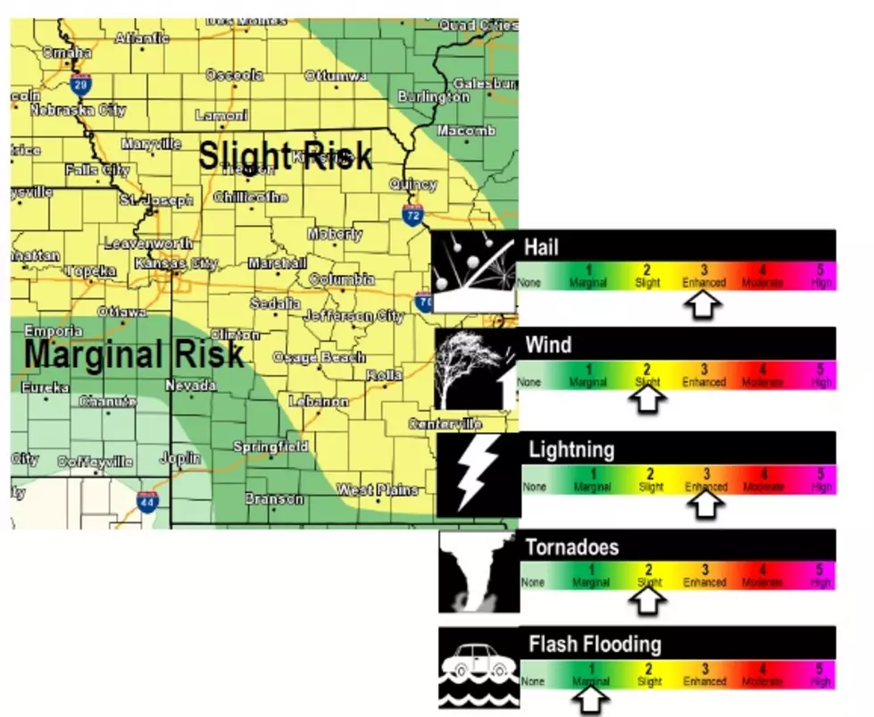
If you look at the map they shared from the National Weather Service Storm Prediction Center West Central Missouri is at an enhanced risk for severe weather.

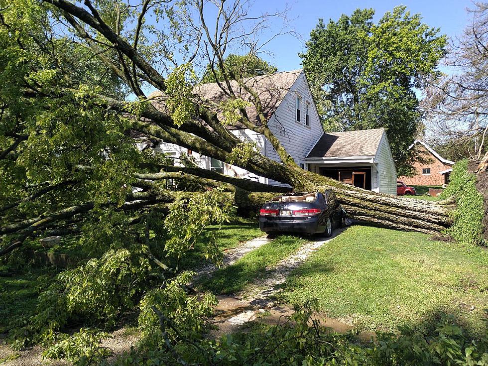
The Storm Prediction Center says much of Missouri could experience severe thunderstorms along with high winds and large hail. While it's not a great prediction, they say the Chicago area and suburbs west of Chicago are at the greatest risk for a tornado late this afternoon or this evening. Of course, that's cold comfort if high winds pull down a tree in the yard, or the vehicle in the driveway gets pelted with large hail leaving dents.
Our forecaster, Weatherology, which tends to take a conservative approach to their forecasts says there's a 65 percent chance of precipitation tonight, and those that receive rain could get around an inch. The National Weather Service's forecast out of Kansas City for Sedalia says showers and storms are likely between 10:00 PM and 2:00 AM CDT.
As far as storm timings go, The National Weather Service says storms are likely in the Lee's Summit & Warrensburg area before 1:00 AM CDT, while Boonville should expect storms between Midnight and 2:00 AM CDT.
Our radio stations will have all National Weather Service alerts, as well as updates from Weatherology, should our area experience severe storms this evening.
TIPS: Here's how you can prepare for power outages
LOOK: The most expensive weather and climate disasters in recent decades
Gallery Credit: KATELYN LEBOFF
More From KIX 105.7