Temps On the Upswing As We Head Towards the Weekend
A nice stretch, albeit small, of warmer temps to invade the area through the first of next week. Keep your fingers crossed.
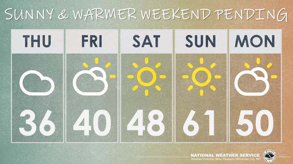
Patchy freezing fog is possible this morning, which may result in slick spots on the roadways during the morning commute. Light snow is possible across northern Missouri late tonight with little to no accumulation. Temperatures will warm through the weekend, with the next chance for precip holding off until the early to mid-week.
Here's the forecast for the Sedalia/Whiteman AFB/ Warrensburg area according to the National Weather Service:
TodayPatchy fog between 7am and 9am. Otherwise, cloudy, with a high near 36. Calm wind becoming south around 6 mph.TonightCloudy, with a low around 28. South southeast wind 3 to 7 mph.FridayCloudy, with a high near 41. South southwest wind 6 to 8 mph.Friday NightMostly cloudy, with a low around 27. West wind 3 to 6 mph.SaturdayMostly sunny, with a high near 47. West wind 6 to 9 mph.Saturday NightMostly clear, with a low around 37.SundaySunny, with a high near 61.Sunday NightMostly clear, with a low around 42.MondayPartly sunny, with a high near 55.Monday NightA chance of rain before 5am, then a chance of rain and snow. Mostly cloudy, with a low around 31. Chance of precipitation is 30%.TuesdayMostly cloudy, with a high near 36.Tuesday NightMostly cloudy, with a low around 23.WednesdaySunny, with a high near 37.
More From KIX 105.7