Get Ready For Another Possible Round of Storms
It was definitely something you heard early Friday morning. One round of thunderstorms rolled through the area and there's more in the forecast.
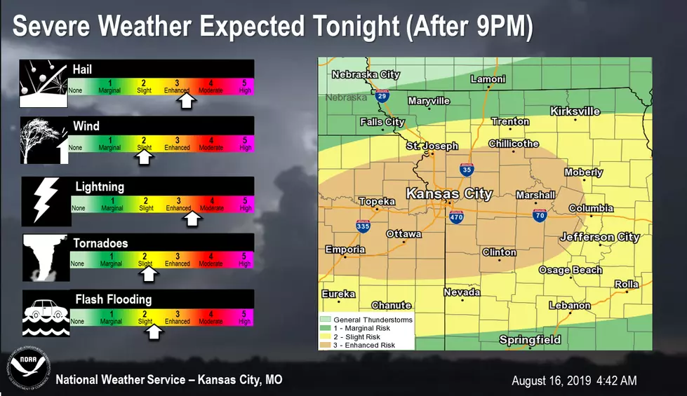
Severe Weather is expected again tonight with all modes of severe weather possible including: large hail (possibly golf ball sized or larger), damaging winds, flash flooding, and even a tornado or two cannot be ruled out. Storms are expected to develop around 9PM tonight. Otherwise sub-severe thunderstorms will be possible this morning before clearing out this afternoon with highs in the low to mid 80s.
Here's the forecast through the end of the 2019 Missouri State Fair according to the National Weather Service:
FridayShowers and thunderstorms likely, mainly before noon. Partly sunny, with a high near 87. South southwest wind 6 to 10 mph. Chance of precipitation is 60%. New rainfall amounts between a tenth and quarter of an inch, except higher amounts possible in thunderstorms.Friday NightShowers and thunderstorms, mainly after 7pm. Low around 68. Southeast wind 5 to 9 mph. Chance of precipitation is 80%. New rainfall amounts between 1 and 2 inches possible.SaturdayA chance of showers and thunderstorms. Mostly cloudy, with a high near 89. Heat index values as high as 96. South wind 6 to 10 mph, with gusts as high as 18 mph. Chance of precipitation is 40%. New rainfall amounts between a tenth and quarter of an inch, except higher amounts possible in thunderstorms.Saturday NightA chance of showers and thunderstorms. Mostly cloudy, with a low around 71. South wind 6 to 8 mph, with gusts as high as 18 mph. Chance of precipitation is 30%. New rainfall amounts of less than a tenth of an inch, except higher amounts possible in thunderstorms.SundayA chance of showers and thunderstorms, mainly before 1pm. Partly sunny, with a high near 88. Chance of precipitation is 40%. New rainfall amounts between a tenth and quarter of an inch, except higher amounts possible in thunderstorms.Sunday NightMostly clear, with a low around 72.
More From KIX 105.7


