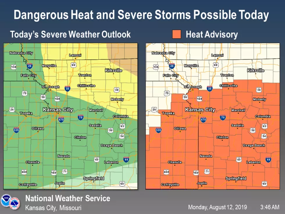
Double Whammy With The Weather
Starting off the fifth day of the 2019 Missouri State Fair with something other than fair weather. As you travel north of the Sedalia/Warrensburg area, your chances of the storms will increase.
Storms will move through northern Missouri this morning. But they will give way to hot and humid conditions along and south of Highway 36. Those hot and humid conditions will also lead to a new round of storms late this afternoon and into the overnight hours. A few storms in northern Missouri could be severe with damaging winds the main hazard.
Here's the forecast according to the National Weather Service:
MondayA chance of showers and thunderstorms, mainly before 8am. Mostly sunny, with a high near 95. Heat index values as high as 106. South southwest wind 5 to 15 mph, with gusts as high as 22 mph. Chance of precipitation is 30%. New precipitation amounts of less than a tenth of an inch, except higher amounts possible in thunderstorms.Monday NightA chance of showers and thunderstorms, mainly after 8pm. Increasing clouds, with a low around 71. Southwest wind 8 to 13 mph becoming northwest after midnight. Chance of precipitation is 40%. New rainfall amounts between a quarter and half of an inch possible.TuesdayA chance of showers and thunderstorms, mainly before 8am. Partly sunny, with a high near 85. North northwest wind 7 to 9 mph. Chance of precipitation is 30%. New rainfall amounts between a tenth and quarter of an inch, except higher amounts possible in thunderstorms.Tuesday NightMostly clear, with a low around 65. North northwest wind 5 to 9 mph becoming calm in the evening.WednesdaySunny, with a high near 82.Wednesday NightMostly clear, with a low around 62.ThursdayMostly sunny, with a high near 82.Thursday NightPartly cloudy, with a low around 66.FridayMostly sunny, with a high near 87.Friday NightPartly cloudy, with a low around 69.SaturdayMostly sunny, with a high near 89.Saturday NightPartly cloudy, with a low around 71.SundayMostly sunny, with a high near 90.
More From KIX 105.7