Wintry Mix to Hit the Area
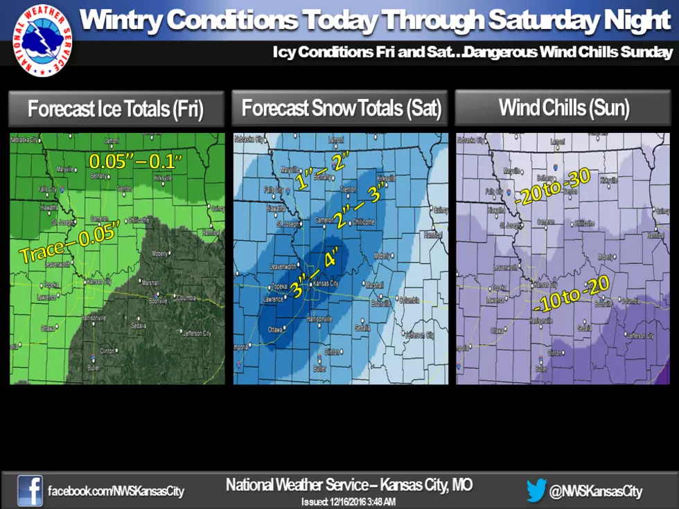
Wintry conditions will affect the area through this weekend. Today there is the chance for freezing drizzle making for slick roadways over much of the area however, the best chance for ice accumulations will occur north of a St Joseph to Kirksville line where freezing rain is expected to be the heaviest and where temperatures are expected to stay below freezing. Up to a tenth of ice is possible across northern Missouri. Freezing drizzle will transition to snow by late morning/early afternoon. With temperatures in the upper single digits and teens, snow ratios will be high and it is possible for 2 to 4 inches of light and powdery snow to accumulate across much of the area by Saturday night. Snow will exit the area Saturday night by midnight. In the wake of this storm system, will be some very cold temperatures with dangerous wind chills by Sunday morning ranging from 10 to 20 degrees below zero across the southern part of the forecast area to 20 to 30 degrees below zero across northern Missouri and northeastern Kansas.
More From KIX 105.7


