Light rain ending this morning. An active pattern will commence on Wednesday, with periods of heavy rain and perhaps some scattered strong to severe thunderstorms Wednesday evening.
A frost advisory is in effect from 4 am to 8 pm Saturday. A combination of the temperature in the low to mid 30's and light winds could result in frost formation.
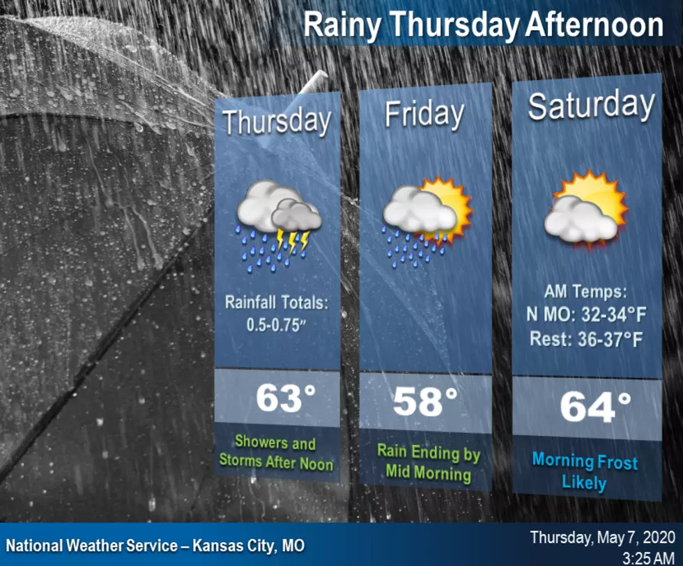
Widespread rain showers and isolated thunderstorms will move into the area after noon today. This rain will continue overnight, but will clear out by mid morning with a nice, but cool, Friday afternoon.
Yesterday was beautiful day. The temperature was in the upper 60's, even hitting the 70 degree mark every once in a while. But it was a windy day. Last night before I shut things down to go to bed I noticed that my scalp was a little red.
A nice early spring-like day today with a cool start in the 40s and 60s by the afternoon. . Widespread rain will return to the area Thursday afternoon into Friday morning, but will clear out for a nice afternoon on Friday and into the weekend.
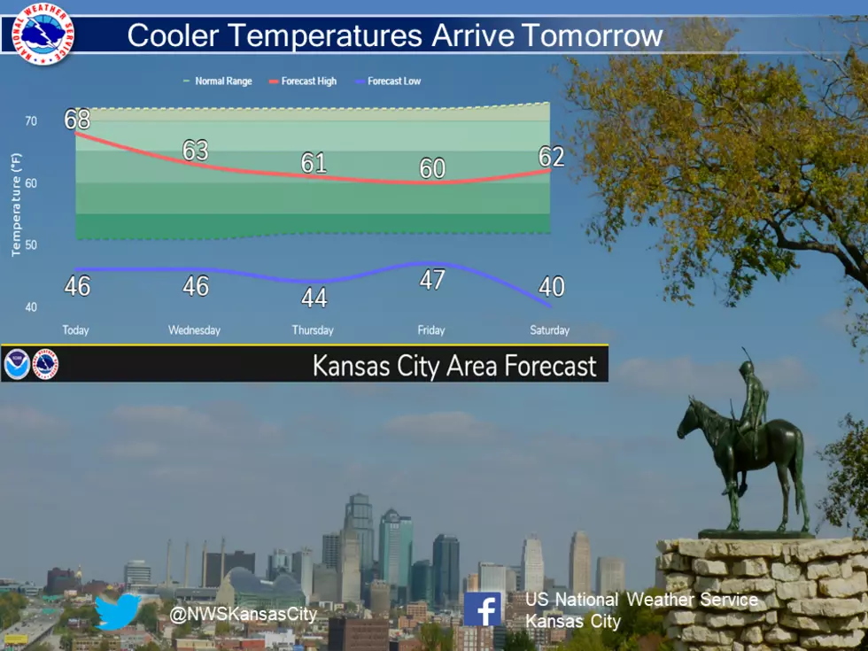
Cooler temperatures will move into the area Starting tomorrow, making it feel more like early April than May. For now, summer temperatures will hold off until at least mid May.
This is one of those times we look at the weather map for Missouri and Kansas and realize that there are no watches or warnings. Could you call it a perfect weather day for May 1? Well, maybe as near-perfect as you could imagine.
It seems as if everyone is wanting to find their own source of vegetable for the remaining spring and summer months. Of course with planting a garden there's some do and don'ts to make it more productive.